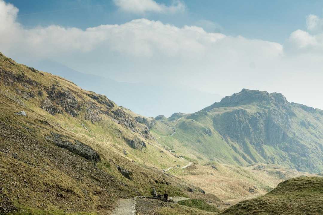
Lake shores, Langdale passes and a northbound crossing of the Lakes.
WHOLE TRAIL112 km / 70 mi
PLANNING PACE5–7 walking days
WALKING EFFORTModerate–challenging
SLEEP INDOORSInns, B&Bs & small hotels
Walk north from Ulverston to Carlisle through Coniston, Great Langdale, Borrowdale and Keswick. Our featured six-day pace adds a Rosthwaite night so the mountain heart of the route has room to breathe.
Loading the map. Places along the route are listed below.
Location overview: numbered pins mark approximate places. Dotted connections show their order, not the walking path. Use the linked route maps for navigation.
ONE-MAP PAPER BACKUP
Carry the whole Cumbria Way on one waterproof sheet.
HARVEY's Cumbria Way map covers the complete route at 1:40,000 on a waterproof strip map, making it the simplest paper backup for the full walk.
Download a current digital route before you leave.
TrailTrack's 2026 Cumbria Way guide provides a full GPX plus stage files and current route notes. Compare any downloaded line with your paper map and signed diversions.
Published totals vary from roughly 112 to 119 km / 70 to 74 mi depending on the mapped line, high-level choices, diversions and links to accommodation. The route is waymarked, but Stake Pass and the northern fell section still justify a paper map plus an offline track.
02 / CHOOSE YOUR SUPPORT
Your walk. Your way of travelling.
You can change this as you plan.
03 / MAKE ROOM FOR THE WALK
The whole trail, or your part of it.
Start with the route length. Then allow time to enjoy it.
Featured six-day crossing
Our preferred pace adds Rosthwaite between Great Langdale and Keswick, giving the mountain heart of the route two shorter, better-balanced days.
Walking-day ranges are planning estimates, not a booked daily itinerary. Choose actual overnight stops and check stage distances before reserving. Rest days add time; they do not shorten walking stages.
This Route Guide gives one practical lodging anchor at each overnight stop on the six-day version. Several sit directly on the Cumbria Way; book Great Langdale, Rosthwaite and Caldbeck early because those smaller stops have less room inventory than Coniston, Keswick or Carlisle.
Know how close the bed is before you book
On the trail means the property or official route source places the stay directly on the Way—no separate off-route transfer is normally planned. Near / stage stop means the stay is at a named stage stop, start or finish; the access note gives the most specific credible distance or relationship we found.
Use the named stay as your map anchor. "View hotel on route map" pins the property alongside approximate stage places. The dotted connections are not the surveyed trail and cannot measure a hotel-to-trail distance. "Open in Google Maps" helps inspect paths and directions; check the official route map for the marked trail. Any access distance or time below comes from its linked source and is labelled when property-reported.
Places on the selected walk
Place
Next walking section
Stays & trail access
1 Ulverston · start
14.9 mi / 24.0 km to Coniston
Stage 1 · 24 km / 15 mi to Coniston, leaving the Furness lowlands for the southern Lake District.
Macs Adventure identifies Church Walk House as the closest accommodation to the start of the Cumbria Way. Use it as the arrival-night anchor before setting out north.
A practical central Ulverston stay with the railway station nearby. Confirm breakfast and check-in around your train arrival.
The Cumbria Way finishes in Carlisle's central Market Square area. The Crown & Mitre is in the city centre close to the route finish and a short walk from the railway station.
A practical finish-night hotel if you want a shower, dinner and one more night before taking the train home.
These are lodging starting points, not reserved rooms. Access notes and any quoted distances come from the linked sources. Confirm your dates, room type, actual walking route and luggage collection with each property before booking.
LUGGAGE TRANSFERS
Choose how often the larger bag moves.
Arrange transfers separately when booking your own walk.
The Cumbria Way works well as a daypack walk. The awkward transfer is Great Langdale to Borrowdale, where the road journey around the mountains is much longer than the walking line, so check the surcharge and covered properties before booking your rooms.
DAYPACK WALKING
Move the main bag each day.
Confirm the complete overnight sequence first, then give the transfer company every exact property and your walking direction.
LANGDALE → BORROWDALE
Expect the mountain-crossing transfer to cost more.
The walker crosses Stake Pass directly, but the luggage van has a long road detour. This is the one stage to check especially carefully.
STANDALONE BAG TRANSFER
Sherpa Van
For 2026 Sherpa Van advertises standard Cumbria Way moves at £17.50 per bag, with a £35 Great Langdale-to-Borrowdale move because of the long road detour; maximum bag weight 20 kg.
Coast to Coast Packhorse operates baggage transfer along the Cumbria Way from Ulverston to Carlisle during the walking season, serving selected hotels, B&Bs, guesthouses and hostels.
Confirm current prices, operating dates, collection times, excluded properties, bag limits, liability and any finish storage directly. An arranged holiday may already include daily transfers.
Booking an arranged trip?
Many self-guided packages include accommodation and daily luggage transfer. Compare their actual overnight settlements with the plan here before booking a separate courier.
Confirm breakfasts, packed lunches, dinner reservations and every off-route transfer.
Arrive in Ulverston the night before, walk north, and finish in central Carlisle within easy walking distance of the railway station.
Open the practical transport guide
Starting in Ulverston
Ulverston is on the Furness Line with rail connections via Lancaster / Barrow. Stay in town the night before so you can start walking without a morning transfer.
Finishing in Carlisle
The Cumbria Way ends in central Carlisle. Carlisle railway station is close to the finish area and has onward services toward London, Glasgow, Edinburgh and northern England.
Useful mid-route transport
Coniston, Great Langdale and Borrowdale rely mainly on buses, taxis or operator transfers; Keswick has strong bus links but no railway station. Check seasonal bus timetables before building an abbreviated section.
As of September 2026 a short section of Public Footpath 114044 / the Caldew Cycleway behind Caldew School near Dalston is temporarily closed, with a signed pedestrian alternative. Check current council and trail notices before the final stage rather than relying on an older GPX alone.
05 / TRIPS OFFERED ON THIS TRAIL
Compare trips from walking-holiday providers.
These are bookable trips offered by independent providers along all or part of this trail. Walking trips are the core comparison; when a genuinely relevant horseback, cycling or running version exists, we label it clearly as a different way to experience the same route landscape.
8 trip options from 8 operators.
Self-guided and guided are both included. Use the Service filter above to separate them. This is a researched selection, not every provider or itinerary. Examples checked 26 September 2026. Starting prices are per person; check your dates, room basis, single supplements and inclusions. Currencies are shown as advertised.
Operator trip options for Cumbria Way
Operator & trip
Service & coverage
Time
Advertised from
Check the details
Coast to Coast PackhorseCumbria Way walking holiday
Self-guidedWhole trail
Choose itinerary
£700 pp
Self-guided packages built around the full route with accommodation and luggage transfer; a Rosthwaite overnight can be added to soften the mountain section.
Guided Outdoor AdventuresGuided Cumbria Way walking holiday
GuidedWhole trail
7 days / 6 nights5 walking days
Check current price
Small-group Mountain Leader trip with five walking days, guesthouse/inn/hotel accommodation and daily luggage transfer. The current published departure runs 27 September–3 October 2026.
Waymarking is generally good, but Stake Pass and the northern fell country deserve proper navigation. Download the route before leaving Wi-Fi and carry a paper backup.
BRITISH TOPO MAPPING
OS Maps
Use Ordnance Survey mapping for rights of way, contours and detailed Lake District terrain. Download the relevant areas before the walk.
Download maps and become familiar with the controls before Stage 1.
Carry the HARVEY map or another suitable paper map, keep the current GPX offline, and follow signed diversions where they differ from an older downloaded track.
BEFORE THE BOOKINGS
Make the plan work on the ground.
Published Cumbria Way totals vary from roughly 112 to 119 km / 70 to 74 mi because of mapping choices, high-level options, diversions and accommodation links. The featured six-day plan uses the commonly published 112 km stage framework. Check current access notices for the final Caldew / Dalston section before departure.
Confirm an indoor bed for every night, the distance to each stay, and how you will reach and leave the route.