OFFICIAL ROUTE SECTIONS
Plan the 15 coastal sections.
The National Park gives section distances, services and safety notes. It lists the trail north to south; reverse the order for this page's Amroth start.
Open the official stage guide ↗ (new tab)WEST WALES · NAMED TRAIL
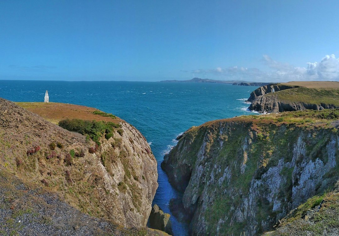
Headlands, small harbours and sweeping sea views.
The full coastal trail links Amroth and St Dogmaels. A shorter trip around Tenby or St Davids offers coastal walking without committing to the entire path.
01 / GET YOUR BEARINGS
Loading the map. Places along the route are listed below.
Location overview: these are selected town pins, not all 15 official section endpoints. The orange line shows the Pembrokeshire main Coast Path in Natural Resources Wales data (2025), simplified for display. Check current diversions on the official map. Use the 15-section walking and lodging sequence below and the official map for navigation.
OFFICIAL ROUTE SECTIONS
The National Park gives section distances, services and safety notes. It lists the trail north to south; reverse the order for this page's Amroth start.
Open the official stage guide ↗ (new tab)COASTAL BUS TIMETABLES
Coastal buses are useful for off-path lodging and shorter days. Check the service for your specific date.
Check county bus timetables ↗ (new tab)The map pins are approximate place anchors, not the walking route. Use the official map for navigation and check tides, access notices and bus times for your date.
OFFICIAL TRAIL SECTIONS
The National Park lists these 15 sections from St Dogmaels to Amroth. The map and planner above currently run the opposite way, from Amroth to St Dogmaels. These are route sections, not guaranteed overnight stops; choose beds and transport before treating them as daily stages.
The first St Dogmaels–Newport section is particularly demanding; the National Park suggests a Moylgrove split for walkers who need a shorter day. Tidal crossings and restricted access affect some southern sections. Read the official section guide ↗
02 / CHOOSE YOUR SUPPORT
You can change this as you plan.
03 / MAKE ROOM FOR THE WALK
Start with the route length. Then allow time to enjoy it.
Choose your pace, then check daily stages and overnight availability.
Walking-day ranges are planning estimates, not a booked daily itinerary. Choose actual overnight stops and check stage distances before reserving. Rest days add time; they do not shorten walking stages.
04 / THE PLACES ALONG THE WAY
The stays below match your route choice in section 03. Use their access notes and the full-trail map to plan each night. Trail distances exclude lodging access and transfers.
Each stop starts with a suggested stay, its trail access and map links. Distances or walking times appear only where sourced; otherwise access is marked unverified. Confirm rooms for your dates.
On the trail Directly on the route.
Near / stage stop In a nearby village or stopping place; extra walking may be needed.
Transfer required Arrange a ride to your room and back to the same trail point.
The orange line shows the trail; pins show stays, sometimes approximately. Use the official route map for navigation.
Choose a route in section 03 to show its stays here. Book your arrival night separately.
| Walking endpoint | Stay and trail access | Walking section |
|---|---|---|
| 1 Skrinkle Haven | At Skrinkle Haven; trail-to-door distance not verified. YHA ManorbierCheck rooms with the property ↗ View stay in Google Maps ↗ · Search Booking.com (results not verified) ↗ View this property on Booking.com ↗ At Skrinkle Haven; check room type and single-night availability. Location or route source ↗ | Suggested stay: YHA Manorbier ↑ Amroth → Skrinkle Haven14 mi / 22.5 km Amroth cliff-path closure: walk the signed alternative via the road. This is a walking diversion; the official notice does not require a taxi or train. Check the current diversion map and signs before setting out. Walking notes & official guidanceStart at Amroth, checking the signed road diversion around the cliff-path landslide closure listed by the National Park (November 2024 notice; checked 28 September 2026). Continue along the coast through Tenby towards Skrinkle Haven. Beaches and views towards Caldey Island alternate with steep valleys and steps; allow time for the climbs around Lydstep. Official section guidance ↗Route source checked 27 Sep 2026. Park descriptions run in the opposite direction. |
| 2 Broad Haven South | Inland at Bosherston; walking distance from the beach not verified. St Govan’s Country InnView stay in Google Maps ↗ · Search Booking.com (results not verified) ↗ Rooms in Bosherston, inland from the beach. Check the walking link via the lily ponds; the extra access is not included in the official section mileage. | Suggested stay: St Govan’s Country Inn ↑ Skrinkle Haven → Broad Haven South11 mi / 17.7 km Walking notes & official guidanceContinue along an undulating coast to the Stackpole area and Broad Haven South. This section includes steep steps and exposed cliff scenery; the inland connection to Bosherston is additional walking. Official section guidance ↗Route source checked 27 Sep 2026. Park descriptions run in the opposite direction. |
| 3 Freshwater West | Pre-book pickup and return to Freshwater West; hotel is in Pembroke. The Coach House Hotel, PembrokeCheck rooms with the property ↗ View stay in Google Maps ↗ · Search Booking.com (results not verified) ↗ View this property on Booking.com ↗ Suggested plan: finish at Freshwater West and take a pre-booked taxi to this hotel in Pembroke. Return to the same agreed beach pickup point next morning to walk towards Angle. Confirm a one-night room and both taxi journeys before booking; transport is separate. This avoids combining two sections into a roughly 20-mile day. Ask Pembroke Cabs about both transfers ↗ Hotel and taxi sources checked 28 September 2026. Availability, pickup point and fare must be confirmed directly. Location or route source ↗ | Suggested stay: The Coach House Hotel, Pembroke ↑ Broad Haven South → Freshwater West10 mi / 16.1 km Check Castlemartin range access before walking. Range West is not generally open. Walking notes & official guidanceMilitary range access determines the route here. Check current Castlemartin closures before setting out and follow the official diversion when necessary. Range West is not generally open to walkers; do not improvise a crossing. Official section guidance ↗Route source checked 27 Sep 2026. Park descriptions run in the opposite direction. |
| 4 Angle | In Angle village; trail-to-door distance not verified. The Globe, AngleCheck rooms with the property ↗ View stay in Google Maps ↗ · Search Booking.com (results not verified) ↗ B&B in Angle village; confirm the signed path connection and room dates. Location or route source ↗ | Suggested stay: The Globe, Angle ↑ Freshwater West → Angle10 mi / 16.1 km Remote section: carry food and water; mobile reception is unreliable. Walking notes & official guidanceA remote, rugged stretch around the Angle peninsula follows the beach at Freshwater West. Carry food and water: facilities and escape routes are limited, and mobile reception cannot be relied on. Official section guidance ↗Route source checked 27 Sep 2026. Park descriptions run in the opposite direction. |
| 5 Neyland | Beyond Neyland at Hazelbeach; extra walking distance not verified. Ferry House Inn, HazelbeachCheck rooms with the property ↗ View stay in Google Maps ↗ · Search Booking.com (results not verified) ↗ View this property on Booking.com ↗ En-suite inn rooms in Hazelbeach, beyond Neyland towards Dale. Ask for a one-night booking for your dates. For the listed section lengths, arrange a ride from Neyland and back next morning; alternatively, walk the onward coast-path section to the inn and shorten the following day. That extra distance is not measured here. Room and location sources checked 28 September 2026; one-night availability is date-specific. Longer-stay alternative: Haven PodsThe marina pods have a minimum two-night stay, rising to five in peak periods, and shared toilet/shower facilities. Consider them only for a longer base stay, not a standard one-night stop. Check pod terms ↗ | Suggested stay: Ferry House Inn, Hazelbeach ↑ Angle → Neyland16 mi / 25.7 km Walking notes & official guidanceThis long section mixes coastal walking with roads and industrial surroundings around the haven. Allow a full day and follow the signed route carefully where the character changes from cliffs to settlements. Official section guidance ↗Route source checked 27 Sep 2026. Park descriptions run in the opposite direction. |
| 6 Dale | At Dale Fort; trail-to-door distance and individual room booking need confirmation. Dale FortCheck rooms with the property ↗ View stay in Google Maps ↗ · Search Booking.com (results not verified) ↗ Field Studies Council lists accommodation at Dale Fort, but an individual one-night room must be confirmed directly. If unavailable, book a room elsewhere with a return transfer to Dale. Tidal crossings can lengthen the preceding section. Location or route source ↗ | Suggested stay: Dale Fort ↑ Neyland → Dale16 mi / 25.7 km Check Gann and Sandy Haven tides; road alternatives add distance. Walking notes & official guidanceThe Gann and Sandy Haven crossings depend on the tide. Check both before planning departure; the road alternatives add distance. The quoted mileage is not a promise that both crossings will be usable. Official section guidance ↗Route source checked 27 Sep 2026. Park descriptions run in the opposite direction. |
| 7 Martin’s Haven | Inland at Marloes; walking distance from Martin’s Haven not verified. The Lobster Pot Inn, MarloesCheck rooms with the property ↗ View stay in Google Maps ↗ · Search Booking.com (results not verified) ↗ Rooms in Marloes village, inland from Martin’s Haven. Arrange the walk or return ride to the same trail point; extra access is not in the 10 miles. Location or route source ↗ | Suggested stay: The Lobster Pot Inn, Marloes ↑ Dale → Martin’s Haven10 mi / 16.1 km Walking notes & official guidanceWalk from sheltered Dale towards the more exposed Atlantic coast, with island views. Much is on a plateau, broken by short steep valleys. The Deer Park loop is an optional addition, not part of this mileage. Official section guidance ↗Route source checked 27 Sep 2026. Park descriptions run in the opposite direction. |
| 8 Broad Haven | About 100 m from the coastal footpath (Visit Pembrokeshire). YHA Broad HavenCheck rooms with the property ↗ View stay in Google Maps ↗ · Search Booking.com (results not verified) ↗ Visit Pembrokeshire places the hostel about 100 m from the coastal footpath; check the room type. Location or route source ↗ | Suggested stay: YHA Broad Haven ↑ Martin’s Haven → Broad Haven11 mi / 17.7 km Walking notes & official guidanceContinue north along low red cliffs towards Broad Haven. The coastal scenery is varied, but the section distance still excludes any inland return from your Marloes accommodation. Official section guidance ↗Route source checked 27 Sep 2026. Park descriptions run in the opposite direction. |
| 9 Solva | In Lower Solva; trail-to-door distance not verified. The Cambrian InnCheck rooms with the property ↗ View stay in Google Maps ↗ · Search Booking.com (results not verified) ↗ View this property on Booking.com ↗ Private rooms in Lower Solva. Walk through the village to the signed Coast Path; exact hotel-to-path distance remains unmeasured. Location or route source ↗ | Suggested stay: The Cambrian Inn ↑ Broad Haven → Solva12 mi / 19.3 km Walking notes & official guidanceNewgale marks a change in effort: the coast north of the beach has steep climbs and many steps. Pace this section for repeated ascent and descent before reaching Solva harbour. Official section guidance ↗Route source checked 27 Sep 2026. Park descriptions run in the opposite direction. |
| 10 Whitesands | About 10 minutes to Whitesands Beach (property-reported); not a measured trail-to-door distance. Craig-Y-Mor B&BCheck rooms with the property ↗ View stay in Google Maps ↗ · Search Booking.com (results not verified) ↗ Property reports about a 10-minute walk to Whitesands Beach. Check the signed connection and availability. St Davids town is a separate inland alternative. Location or route source ↗ | Suggested stay: Craig-Y-Mor B&B ↑ Solva → Whitesands13 mi / 20.9 km Walking notes & official guidanceFollow the coast around the St Davids peninsula towards Whitesands. St Davids town is inland, so visits or overnight stays there require a separate connection from the Coast Path. Official section guidance ↗Route source checked 27 Sep 2026. Park descriptions run in the opposite direction. |
| 11 Porthgain | In Trefin beyond Porthgain; extra walking distance not verified. The Ship Inn, TrefinCheck rooms with the property ↗ View stay in Google Maps ↗ · Search Booking.com (results not verified) ↗ Rooms in Trefin beyond Porthgain, not at this endpoint. Confirm an onward walk or ride and precisely where the next day resumes so no path is missed. Single-night availability is unverified. | Suggested stay: The Ship Inn, Trefin ↑ Whitesands → Porthgain10 mi / 16.1 km Remote cliffs: carry supplies and check seasonal facilities. Walking notes & official guidanceRemote, rugged cliffs and the St Davids Head area make this more demanding than its mileage suggests. Carry supplies and check seasonal facilities rather than relying on an open café. Official section guidance ↗Route source checked 27 Sep 2026. Park descriptions run in the opposite direction. |
| 12 Pwll Deri | Pre-book pickup and return to Pwll Deri; guesthouse is in Abercastle. Garn Isaf, AbercastleCheck rooms with the property ↗ View stay in Google Maps ↗ · Search Booking.com (results not verified) ↗ The former YHA hostel now offers exclusive hire of the whole building, not an individual walker’s bed. Garn Isaf is a B&B near Abercastle; arrange a ride from Pwll Deri and back to the same point next morning. Check its room dates and the transport before booking. Location or route source ↗ | Suggested stay: Garn Isaf, Abercastle ↑ Porthgain → Pwll Deri12 mi / 19.3 km Walking notes & official guidanceContinue north through coastal villages and exposed cliff sections. Porthgain’s old stoneworks mark the starting harbour; watch for current erosion diversions and agree your Pwll Deri pickup before leaving. Official section guidance ↗Route source checked 27 Sep 2026. Park descriptions run in the opposite direction. |
| 13 Fishguard | In Fishguard town; trail-to-door distance not verified. The Manor Town HouseCheck rooms with the property ↗ View stay in Google Maps ↗ · Search Booking.com (results not verified) ↗ Guesthouse in Fishguard town; confirm the walking connection from the Coast Path and room dates. Location or route source ↗ | Suggested stay: The Manor Town House ↑ Pwll Deri → Fishguard9 mi / 14.5 km Walking notes & official guidanceRocky volcanic terrain and exposed cliffs make for uneven walking on the way to Fishguard. Allow for slower footing; the overnight town connection needs checking separately from the trail distance. Official section guidance ↗Route source checked 27 Sep 2026. Park descriptions run in the opposite direction. |
| 14 Newport | About 5 minutes’ walk to the Coast Path (property-reported). Cnapan Guest HouseCheck rooms with the property ↗ View stay in Google Maps ↗ · Search Booking.com (results not verified) ↗ Property reports a five-minute walk to the Coast Path; check the signed connection. Location or route source ↗ | Suggested stay: Cnapan Guest House ↑ Fishguard → Newport12 mi / 19.3 km Walking notes & official guidanceContinue from Fishguard towards Newport through coastal valleys and cliff scenery. The route distance ends at the section boundary; confirm the connection into Newport and your guesthouse. Official section guidance ↗Route source checked 27 Sep 2026. Park descriptions run in the opposite direction. |
| 15 St Dogmaels | Beyond the finish in Cardigan; extra walking distance not verified. Albion Aberteifi, CardiganCheck rooms with the property ↗ View stay in Google Maps ↗ · Search Booking.com (results not verified) ↗ Finish at the official trail marker first. This hotel is in Cardigan after the St Dogmaels terminus. The additional walking distance to the hotel has not been measured here; confirm the route or arrange a transfer. Location or route source ↗ | Suggested stay: Albion Aberteifi, Cardigan ↑ Newport → St Dogmaels15.5 mi / 24.9 km Demanding final section: allow enough food, water and daylight. Walking notes & official guidanceThe final section to St Dogmaels is one of the route’s most demanding. Start with enough food, water and daylight for the long cliff walk. Finish at the official marker before continuing or transferring to Cardigan. Official section guidance ↗Route source checked 27 Sep 2026. Park descriptions run in the opposite direction. |
Walk every official section in order. The walking endpoint and overnight town can differ. Where a room is away from the endpoint, arrange transport back to the exact trail point next morning; the Park section breaks are a coverage checklist and do not imply a room at each stop. The Park publishes 186 mi for the whole route while its 15 rounded section estimates add to 181.5 mi. Neither figure includes lodging detours. Room availability, minimum stays, tides and range access require a date-specific check.
| Place | Coast Path distance toward next place | Stays & trail access |
|---|---|---|
| 1 Amroth | 7 mi / 12 km to Tenby |
Wiseman's Bridge Inn ↗ (new tab)Call inn to book B&B room ↗ (new tab) Inn B&B rooms above the bar The inn is beside the Coast Path at Wisemans Bridge, about 1.4–1.5 mi / 2.2 km along the path from the Amroth start. Allow for this approach if staying the night before. View hotel on route map ↓Open in Google Maps ↗ National Park trail facilities listing ↗ (new tab)Source checked 25 Sep 2026Broader Booking.com search around Amroth ↗ (new tab)Not filtered by distance from the trail. First open the named anchor stay above, then compare alternatives on the map and verify the walking route.
|
| 2 Tenby | 46 mi / 74 km to Pembroke Long gap: split this into several walking days and book intermediate stays. |
Giltar Hotel ↗ (new tab)Check hotel availability ↗ (new tab) Seafront hotel rooms At 9 Esplanade overlooking South Beach. Check the signed Coast Path connection on foot; no measured hotel-to-path distance is available. View hotel on route map ↓Open in Google Maps ↗ Hotel rooms and location ↗ (new tab)Source checked 25 Sep 2026Broader Booking.com search around Tenby ↗ (new tab)Not filtered by distance from the trail. First open the named anchor stay above, then compare alternatives on the map and verify the walking route.
|
| 3 Pembroke | 22 mi / 36 km to Dale Plan stages around the Milford Haven waterway; this is not a single walking day. |
Access not checkedBroader Booking.com search around Pembroke ↗ (new tab)This Route Guide has not yet verified a specific property here. Explore availability, then verify the walking connection to the official trail before booking.
|
| 4 Dale | 10 mi / 16 km · Dale to Martin's Haven Marloes village access is additional. |
Access not checkedBroader Booking.com search around Dale ↗ (new tab)This Route Guide has not yet verified a specific property here. Explore availability, then verify the walking connection to the official trail before booking.
|
| 5 Marloes | 11 mi / 17 km · Martin's Haven to Broad Haven Access from Marloes village to the path is additional. |
Access not checkedBroader Booking.com search around Marloes ↗ (new tab)This Route Guide has not yet verified a specific property here. Explore availability, then verify the walking connection to the official trail before booking.
|
| 6 Broad Haven | 11 mi / 18 km to Solva |
YHA Broad Haven ↗ (new tab)Check hostel rooms ↗ (new tab) Hostel with room options; check the room type when booking Visit Pembrokeshire places the hostel about 100 m / 0.06 mi from the coastal footpath and Broad Haven beach. This is a published proximity claim, not a surveyed walking detour. View hotel on route map ↓Open in Google Maps ↗ Visit Pembrokeshire lodging listing ↗ (new tab)Source checked 25 Sep 2026Broader Booking.com search around Broad Haven ↗ (new tab)Not filtered by distance from the trail. First open the named anchor stay above, then compare alternatives on the map and verify the walking route.
|
| 7 Solva | 4 mi / 7 km · Solva to Caerfai Access into St Davids town is additional. |
The Cambrian Inn ↗ (new tab)Book a room directly ↗ (new tab) Five en-suite B&B rooms above the inn At 6 Main Street in Lower Solva, close to the harbour. The Coast Path crosses the village; check the signed connection for your walking direction. The hotel-to-path walking distance has not been measured. View hotel on route map ↓Open in Google Maps ↗ Visit Pembrokeshire rooms and location ↗ (new tab)Source checked 25 Sep 2026Broader Booking.com search around Solva ↗ (new tab)Not filtered by distance from the trail. First open the named anchor stay above, then compare alternatives on the map and verify the walking route.
|
| 8 St Davids | 10 mi / 16 km · Whitesands to Porthgain National Park section distance; access from St Davids to Whitesands is additional. |
Tŵr y Felin Hotel ↗ (new tab)Check hotel availability ↗ (new tab) Private rooms and restaurant On Caerfai Road in St Davids; the hotel reports about a 1 mi / 1.6 km walk to Caerfai Beach and the Coast Path. This is a property-reported walking estimate, not a measured hotel-to-trail offset. View hotel on route map ↓Open in Google Maps ↗ Hotel directions and beach walk ↗ (new tab)Source checked 25 Sep 2026Broader Booking.com search around St Davids ↗ (new tab)Not filtered by distance from the trail. First open the named anchor stay above, then compare alternatives on the map and verify the walking route.
|
| 9 Porthgain | 21 mi / 34 km to Fishguard The National Park divides this into Porthgain to Pwll Deri to Fishguard; plan an intermediate stop. |
Access not checkedBroader Booking.com search around Porthgain ↗ (new tab)This Route Guide has not yet verified a specific property here. Explore availability, then verify the walking connection to the official trail before booking.
|
| 10 Fishguard | 11 mi / 18 km to Newport |
Access not checkedBroader Booking.com search around Fishguard ↗ (new tab)This Route Guide has not yet verified a specific property here. Explore availability, then verify the walking connection to the official trail before booking.
|
| 11 Newport | 16 mi / 25 km to St Dogmaels |
Cnapan Guest House ↗ (new tab)Check rooms directly ↗ (new tab) Newport guest house On East Street in Newport; the guest house says the Coast Path is a five-minute walk. This is a property-reported time, not a measured distance; verify the exact signed access on the map. View hotel on route map ↓Open in Google Maps ↗ Guest house coastal path claim ↗ (new tab)Source checked 25 Sep 2026Broader Booking.com search around Newport ↗ (new tab)Not filtered by distance from the trail. First open the named anchor stay above, then compare alternatives on the map and verify the walking route.
|
| 12 St Dogmaels | Trail finish |
Access not checkedBroader Booking.com search around St Dogmaels ↗ (new tab)This Route Guide has not yet verified a specific property here. Explore availability, then verify the walking connection to the official trail before booking.
|
These are lodging starting points, not reserved rooms. Access notes and any quoted distances come from the linked sources. Confirm your dates, room type, actual walking route and luggage collection with each property before booking.
LUGGAGE TRANSFERS
Arrange transfers separately when booking your own walk.
For a DIY walk, ask the courier to confirm each exact overnight address, the service direction, any off-path collection and the endpoint bag handoff before booking beds.
DAYPACK WALKING
Book every overnight and ask a courier to confirm pickups and drop-offs at those exact properties.
SHORTER SECTION
Around St Davids or Tenby, dated coastal buses may allow several day walks from one hotel.
LOCAL BAG SERVICE
Advertises baggage transfers on the Pembrokeshire Coast Path. Request a quote for the exact itinerary and walking direction.
Check Walkalongway ↗ (new tab)LOCAL WALKING HOLIDAYS
Listed by Wales Coast Path for transport and luggage moves. Ask whether bag-only service covers your chosen stops.
Ask VIP Wales ↗ (new tab)Confirm current prices, operating dates, collection times, excluded properties, bag limits, liability and any finish storage directly. An arranged holiday may already include daily transfers.
Many self-guided packages include accommodation and daily luggage transfer. Compare their actual overnight settlements with the plan here before booking a separate courier.
Confirm breakfasts, packed lunches, dinner reservations and every off-route transfer.
Compare operator trips →Neither trail endpoint is a rail station. Plan your dated bus or taxi connection to St Dogmaels or from Amroth before booking the first and last nights.
Use Tenby or Saundersfoot as the rail gateway and check the local bus to Amroth; a taxi may be needed outside the service period.
Use the local connection via Cardigan, including the Poppit Rocket walker bus when running, or pre-book a taxi.
The Strumble Shuttle, Puffin Shuttle, Celtic Coaster and Coastal Cruiser connect parts of the route with towns. Verify the actual seasonal timetable and last service for each day.
The Dale–Neyland official section has tidal crossings and road alternatives; the Freshwater West section can have military restrictions. Check current route notices and tide times.
Check current route notices, tide times, Sunday service, last departures and taxi availability for your exact travel dates.
05 / TRIPS OFFERED ON THIS TRAIL
These are bookable trips offered by independent providers along all or part of this trail. Walking trips are the core comparison; when a genuinely relevant horseback, cycling or running version exists, we label it clearly as a different way to experience the same route landscape.
8 trip options from 7 operators.
Self-guided and guided are both included. Use the Service filter above to separate them. This is a researched selection, not every provider or itinerary. Examples checked 25 September 2026. Starting prices are per person; check your dates, room basis, single supplements and inclusions. Currencies are shown as advertised.
| Operator & trip | Service & coverage | Time | Advertised from | Check the details |
|---|---|---|---|---|
| Hillwalk ToursAmroth / Tenby–St Davids · moderate | Self-guidedRegional itinerary | 7 days / 6 nights5 walking days | Check current price | One of Hillwalk's 4–11 day gentle, moderate and challenging choices. Two coastal areas joined by transfer; not the full 186-mile trail. View trip with Hillwalk Tours ↗ (new tab) |
| Hillwalk ToursTenby–Bosherston / Pembroke · gentle | Self-guidedTrail section | 4 days / 3 nights2 walking days | Check current price | View trip with Hillwalk Tours ↗ (new tab) |
| Contours Walking HolidaysComplete coast path · choose 13–19 nights | Self-guidedWhole trail | Choose itinerary | Check current price | Full path; multiple paces and a reverse-direction choice. Confirm your selected stages and lodging transfers. View trip with Contours Walking Holidays ↗ (new tab) |
| Macs AdventureComplete coast path · 16 days | Self-guidedWhole trail | 16 days / 15 nights14 walking days | Check current price | Amroth to St Dogmaels, with Cardigan often used for the final bed. Bags and route app included; check any extra town access or bus and taxi costs. View trip with Macs Adventure ↗ (new tab) |
| Celtic TrailsAmroth to St Dogmaels · relaxed full route | Self-guidedWhole trail | 19 days / 18 nights17 walking days | £2,605 pp | Longer full-route schedule with 17 walking days, lodging, bag moves and standard accommodation-to-path transfers; price shown for two sharing in 2026. View trip with Celtic Trails ↗ (new tab) |
| Ramble WorldwideWestern coast · Dale to Pwll Deri | GuidedTrail section | 8 days / 7 nights6 walking days | Check current price | Led group of roughly 10–12 on a challenging western section; half board and transfers to trailheads. Published departures shown for 2027. View trip with Ramble Worldwide ↗ (new tab) |
| HF HolidaysBest of the coast · St Davids base | GuidedRegional itinerary | 8 days / 7 nights6 walking days | Check current price | Small guided group based in St Davids, walking selected coast sections with transport; half board. Advertised price is non-member rate. View trip with HF Holidays ↗ (new tab) |
| VIP WalesTailored place-to-place coast walks | Self-guidedRegional itinerary | Choose itinerary | Check current price | Local custom itinerary with lodging and bag transport. Ask which coastal sections are continuous and which use vehicle transfers. View trip with VIP Wales ↗ (new tab) |
BEFORE THE BOOKINGS
Repeated climbs make coastal miles tiring. Hillwalk’s Tenby–St Davids trips include a transfer and do not cover the whole trail.
Confirm an indoor bed for every night, the distance to each stay, and how you will reach and leave the route.
Pembrokeshire Coast National Park · trail ↗Planning guide · Facts checked 25 September 2026. Dates, access and services may change.
Explore all walks